top of page
Overnight Trips
Cibecue Falls
The Cibecue Creek Trail a hidden gem among thousands at the White Mountain Apache tribe. Most people go to Arizona to see the Grand Canyon, and rightfully so, however Cibecue Creek Trail offers something both Big Horn Canyon and the Grand Canyon cannot, a chance to explore it all up close and personal with a kiss from a pristine waterfall. There’s a campground close to the start of the trail. Tribal permits are required for camping and the hike.


Mt Lemmon
In the summer, Mt. Lemmon is 20-25 degrees cooler than Tucson and only one hour away making it the perfect shorter trip. Numerous campgrounds (both free and paid) are available along with hiking, biking, fishing and just soaking in the stunning Sky Island scenery.


Madera Canyon and Hwy 62
A very scenic drive along Hwy 62 can be combined with a visit to Madera Canyon and dispersed camping.The canyon and its immediate surroundings are home to a wide variety of flora and fauna, ranging from cactus covered desert in the lower reaches of the canyon to aspen and pine forest on Mount Wrightson.
With fifteen species of hummingbirds, elegant trogon, sulphur-bellied flycatcher, black-capped gnatcatcher, flame-colored tanager, thirty-six species of wood warblers, and over 256 species of birds documented in total, Madera Canyon is rated the third best birding destination in the United States. Other animals that can be found in Madera Canyon include black bear, mountain lion, bobcats, white-tailed and mule deer, foxes, coatis, ring-tailed cats, raccoons, wild turkeys, squirrels, and rabbits. Sixteen species of bats have also been recorded in the canyon.


Carr Canyon
From US Forest Service:
https://www.fs.usda.gov/recarea/coronado/recarea/?recid=25476
If you look up at the Huachuca Mountains from the town of Sierra Vista, a band of sheer cliffs bends and curves across the face of the mountain range. The relatively flat area above is called the Carr Reef. In this case, however, the word “reef” doesn’t refer to coral and oceans. It harks back to an earlier time when it also meant a thick layer of exposed rock. While you’re looking at the Reef, you may also notice a tree-covered break in that impressive barrier, just south of a deep canyon. Look even closer and you should see a barely visible set of switchbacks climbing that slope. That is the Carr Canyon Road, the only road into the upper reaches of the Huachuca Range. This narrow, winding road was built at the turn of the century to open up the Carr Reef to gold and silver mining. It was reconstructed in the late 1930's by the Civilian Conservation Corps. The mines have come and gone, but the road persists with little change. The people who travel it, however, have changed considerably. Where hardy prospectors once searched for their pot of gold at the end of the rainbow, outdoor recreationists and history buffs now travel the Carr Canyon Road to enjoy splendid scenery and seek the flavor of the past. For them, the Carr Canyon Road provides the reward of extraordinary views of Sierra Vista, the San Pedro Valley, and a number of surrounding mountain ranges as it winds its way up the mountain. Since the road is so narrow, we recommend for safety that you use one of the pullouts along the road if you want to stop and enjoy the view. A forest recreation area stands in an area once occupied by the mining outpost of Reef. Here, you’ll find the Reef Townsite Loop Trail and two scenic forest campgrounds.


Patagonia Ghost Town Loop
This 4-5 hour drive goes through five forgotten ghost towns as well as stunning scenery along the way from Patagonia all the way to the Mexican border. Several dispersed camping spots are available on the way.


Aravaipa Canyon East Entrance


From americansouthwest.net:
https://www.americansouthwest.net/arizona/aravaipa-canyon/index.html
Some of the best hikes in Arizona are along riparian desert canyons, where permanent streams flow through rocky gorges, flanked by trees, bushes and wildflowers, with arid, cactus-covered slopes rising high above, and one of the most famous locations is Aravaipa Canyon, 50 miles north of Tucson at the foot of the Galiuro Mountains.
The east entrance to Aravaipa Canyon is 10 miles beyond the semi ghost town of Klondike, along an unpaved, sometimes rough track that fords Aravaipa Creek several times, so a high clearance vehicle is required. The last 2 miles crosses land prone to flooding, hence visitors are advised to park before, on the north side of the creek at the junction with Bear Canyon. The furthest parking area is at the junction with Turkey Creek, right at the edge of the wilderness area, where the track turns south, heading up this side canyon.
It is possible to camp at the parking area. A permit is required to enter Aravaipa Canyon. The permit should be reserved well in advance during the peak times of March-May and October-November.
Ruby Ghost Town
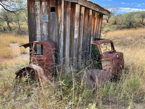
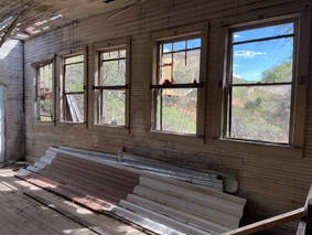
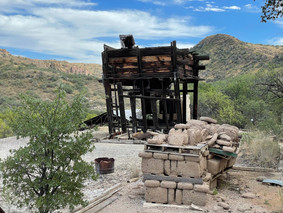
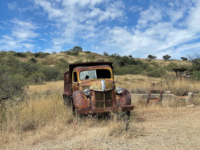
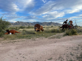
Two hours away from Tucson & 4 miles shy of the border of Mexico is a rare opportunity to look back at over a century of Arizona's mining history. From a once-thriving community of 1,200 people to a modern-day ghost town. The ruins are in various states of decay and you're free to wander around on your own. Some of the highlights include staring down an 800 ft mine pit and exploring ruins in their "unpreserved" state. For a true spooky ghost town experience you can camp overnight next to the school house or next to the town lake where you can go bass fishing! (catch and release only since lead was mined)


Cochise Stronghold in the Dragoon Mountains
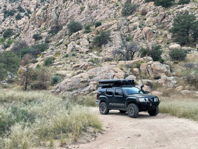
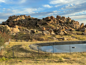
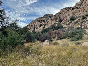
A piece of history in a rugged and mystical setting is 1.5 hours away from Tucson. This beautiful woodland area lies in a protective rampart of granite domes and sheer cliffs which were once the refuge of the great Apache Chief, Cochise, and his people. This rugged natural fortress was, for some 15 years, the home and base of operations for the famed Chiricahua Apache Chief, Cochise. Cochise and about 1,000 of his followers, of whom some 250 were warriors, located here.
In the present day, the National Forest Service operates a scenic campground in the foothills and dispersed camping right next to the cliff edges is also possible. The Cochise Indian Trail goes from the East Cochise Stronghold Campground, over the Stronghold Divide and down into the West Stronghold Canyon. This trail is approximately 5 miles long one way.


bottom of page
